HOME
Another great ride! The morning (6am) of July 29, I left Holland (Michigan, N42 47.206 W86 06.890 ) with my riding buddy Barry Bandstra, to ride our motorcycles to the Canadian border province of Newfoundland. That, of course, meant many miles and spending time on ferries.
Other than playing around with Garmin's Basecamp software, exploring Google Maps, and reading Rannie Gillis and Ken Aiken's Motorcycle Journeys through Atlantic Canada, our preparation was limited to a few breakfast conversations at Jackie's Place and making reservations on the Newfoundland ferry. With both our bikes ready to roll at all times, finding a starting date was determined by birthdays and other commitments.
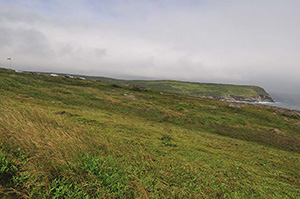
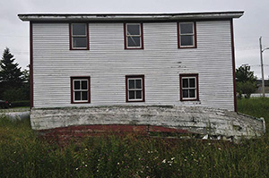
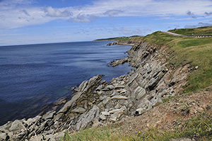
Newfoundland is an island in the North Atlantic off the coast of Canada. The Viking Leif Eriksson visited the island in the 11th century, making him the first Westerner to enter the new world. The island was later visited by John Cabbot or Giovanni Caboto, an Italian working for King Henry the 8th of England. Cabbott arrived in Newfoundland in 1497. Newfoundland officially joined the British Empire in 1583. Portguese, French, and Spanish sailors all visited the island those early days. Before Eriksson arrived, however, the Beothuk people called Newfoundland home. Newfoundland attracted me not only because of its historical nature, but also because it includes the most easterly point in North America, Cape Spear. As I slowly follow my long-term goal to circumnavigate the globe on a motorcycle, this trip would conclude the North American section.
Day 1 — Friday July 29, 2011
Barry and I left Holland after a thunderstorm earlier the morning. We remained dry, though, and soon saw blue skies and sunshine. It turned out to be a lovely day as we ran hard to gain miles. Our aim was friends in Montreal. We crossed into Canada at Port Huron/Sarnia without trouble and made our way towards Toronto. We made good time until we were almost through Toronto and came to a standstill in rush hour traffic on the Friday afternoon before a long weekend. Every living person wanted to leave Toronto, and they all went northeast, direction Montreal. And did I mention it was hot?! We finally got off Route 401, tried to bypass the traffic, but lost so much time that we ended a few hours short of Montreal. Finding a campsite on my iPad's Woodall's Campground Directory led to nothing and we got a hotel for the first night. The local diner served large portions of food that did a good job filling us and rehydrating us, but could not prevent me forgetting the place's name. Some part of me, I guess, does not want to return there soon. I did not keep detailed tracks but I estimate we did 650 miles in hot conditions.
Day 2 — Saturday July 30, 2011
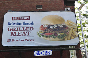
We left our hotel and headed towards Montreal. An uneventful ride was enlivened by road construction as we followed the signs for Quebec City. Gassing up in Brockville, we saw an interesting sign for "Grill therapy" (See picture below). As members of the M.E.A.T Club, Barry and I immediately knew what was meant by the billboard.
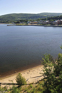
Just north of Quebec City after having seen city center, we got onto RT 138 that follows along the northern bank of the St. Lawrence River. Suddenly the ride took on a different pace. No more holding on for dear life with interstate traffic, we rolled over hills as the river constantly proclaimed a presence next to us. At Baie-Saint-Paul we got onto RT362, a road with curves, ups, downs, and wonderful small waterfront towns. Coming off of Lyme Disease and experiencing some joint pain because of it, my joints were kept loose by constantly waving at the hundreds of motorcyclists (mostly Harleys) on the road. Never have I seen a group of motorcyclists so eager to greet a fellow rider.
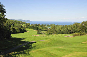
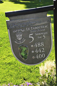
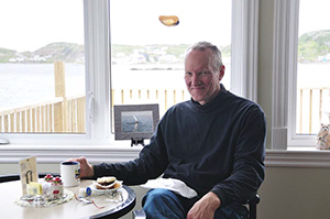
We stopped at La Malbaie to stretch legs and appreciate the vista by stopping at a golf course with amazing elevations: Club de Golf Fairmont Le Manoir Richelieu. I promised myself I'd return one day just to golf here.
 Barry speaking to a French couple
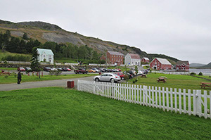
 The town of La Malbaie
We continued onto Saint Simeon and for the first time in this Francophone region of Canada we experienced the meaning of lost in translation. Next to our hotel, that had a lovely view of the St. Lawrence and near the ferry we needed to catch to go to New Brunswick, was a restaurant. Sensing we are English we were assigned a waitress who has some English skills. The menu is all French. I ask her if they have salmon on the menu and she says yes. I order a salmon steak with salad, feeling good about my healthy choice. Barry follows my lead. We enjoy a local beer--included in the meal--and wait. And wait. When our food finally arrives it is a cheese and scallop casserole with potatoes. Having waited so long, we decide to live with the language difficulties of life and enjoyed the meal.
Day 3 — Sunday July 31, 2011
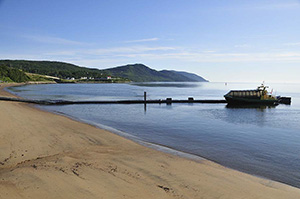
We woke to another beautiful morning and headed for the ferry terminal to take us to Riviere-du-Loup, still in Quebec, but not on the south bank of the St. Lawrence. The ferry offered us a hearty breakfast as we crossed the 22km/13.5 mile stretch of water. We were joined by numerous Harley Davidson riders, some Honda Goldwing riders, and many cars as we all got onto RT20 to explore the Gaspé Peninsula. Gaspesie is the tourist area of Quebec and we could see it. Boutique farms that reminded me of Lancaster's Amish with their restaurants and markets, invited tourists in for business. The sun was bright and I was getting sunburnt despite a dark, reflective visor and factor 50 sunscreen, the side-effects of the antibiotics I was taking for the Lyme Disease.
Waiting for the ferry next to St. Simeon beach. We were first in line.

Breakfast on the ferry was pretty good
We had to make some time to catch the ferry to Newfoundland in Nova Scotia, and cut across Gaspesia following RT 132. It was a fun road to be on, following the Salmon River as we headed South and East.
Crossing into New Brunswick the scenery changed with lush natural forest and many warnings to watch out for moose. We followed RT 11 along Chaleur Bay eating up miles. As we reached Bathurst late the afternoon, tired and hot, we decided to call it a day. Seeking some respite, we hotelled it at the Comfort Inn, which was walking distance from a few pizza places. We decided upon Pizza Delight and had a great meal. As a bread lover I appreciated the fact that numerous breads with spreads were available and you toasted them yourself.
Day 4 — Monday August 1, 2011
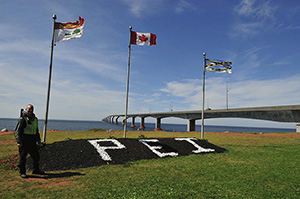
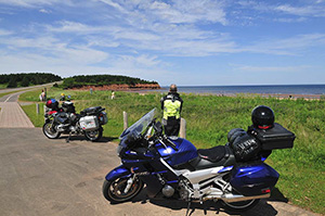
Today we're headed to Prince Edward Island. Following RT 11 and then RT15 we arrived in a windy, but sunny PEI. After checking in at the Tourist Information Office and reserving a tent site for that evening before we would catch a ferry to Caribou, Nova Scotia, we were excited to explore the island for the day. Barry mentioned to me that Japanese tourists like to get wed at Green Gables and we saw a few busses that would fit that description, each passenger armed with a camera and some with two. Beautiful farms, mostly potato but also some canola and corn, welcomed us. Soft shoulders on the road prevented any photos, but the memories will last.
 Barry with Confederation Bridge, all 8 miles/12.9km of it, in the background
Trying to avoid the sun I used a new sunblock that promptly entered my eyes and they burnt to the point of almost not being able to keep them open. I was leading us at that moment and promptly took us of course. What should have been a 20 minute ride to Cavendish became a 2 hour trip as I took us north and west instead of south and east. Finally recognizing we're going the wrong way, we turned around and on the way to Cavendish had out first lobster sandwich at Subway. Should Subway ever bring this to the USA, I'd be a regular customer.
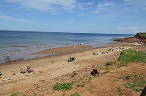
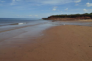
The red sands of Cavendish Beach

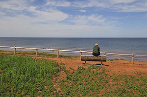
Apparently the first sunny day in more than a week. Barry contemplating his next ride

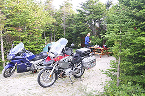
We then explored the red sands of Cavendish Beach before taking back roads to avoid Charlottetown to go to Woods Island. Arriving at the Northumberland Provincial Park we received our site and trying to get back on the bike, I promptly dropped it. A seasoned dropper after the Continental Divide Ride, I rolled away and no harm was done to ego or bike. Our site in the Northumberland Provincial Park was of the best, right on the Northumberland Strait looking towards Cape Breton Island. Barry set off to get us beer and something to eat and after an hour returned with some beans. We were some ways away from any civilization. Barry helped a young couple inflate their air mattress and we received information for the ride back about the Fundy Coast.
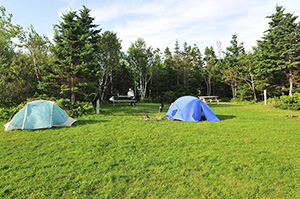
Our lovely site at Northumberland Provincial Park, Woods Island (PEI)
Day 5 — Tuesday August 2, 2011
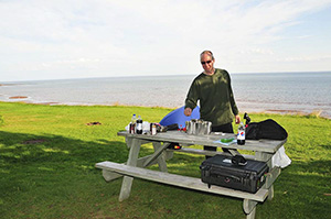
We started the day with another ferry and an onboard breakfast. Tonight we had to be in North Sydney, Nova Scotia, to be on the ferry for Port Aux Basques the next day. We made our way following RT104 saving Cape Breton for the ride back. We did stop at Baddeck where we first visited the Alexander Graham Bell Museum and then had a light lunch. Both of us were surprised that Bell invented many things we never knew about and that his interest in inventing stemmed from helping persons who were deaf. He did research on lambs, for example, and after thirty odd years of research came to the conclusion his thinking that ewes with more nipples have more twins, was wrong. Known of course for inventing the telephone, he also played with hydrofoils, planes, submarines, and more. The museum loans (free) kites to fly, and I helped a young man get his into the air. This museum is well worth a visit.
Kite flying at the Alexander Graham Bell Museum
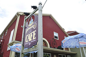
Lunch with crows watching us
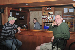
After a good visit to Baddeck we headed to North Sydney, only to discover few options in lodging. We continued a few miles down to road and stayed in Sydney at the Comfort Inn. We explored the board walk--not much to experience--and had a good meal after some waiting at Governors Pub and Eatery.
Day 6 — Wednesday August 3, 2011
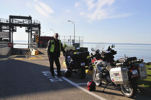
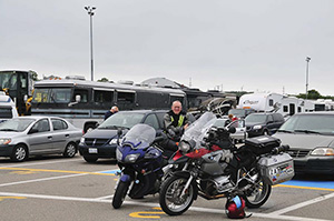
We woke to some rain and after a breakfast at the hotel, we headed to line up with many other motorcyclists, many more cars and trucks to take the 5+ hour ferry ride to Port Aux Basques, Newfoundland. While waiting for boarding to proceed, we had good conversations with the other bikers. One couple from Montreal on a Honda Goldwing trailored a popup camper that looked HUGE behind the bike. Barry and I often reflected on what it must be like to stop that setup.
The Marine Atlantic Ferry was big, gulping up trucks and RVs and more with room to spare. It had wifi on board, though it was slow. The entertainment was less entertaining but we read and talked with fellow bikers as we headed to Port Aux Basques. The town forms the western end of Trans-Canada Highway 1. We would follow it to its western end at St. John's.
First in line for the ferry to Newfoundland. Are we eager or what?

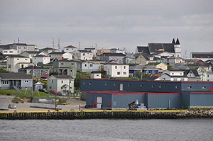
Barry catching up on email. The first home we saw approaching Port Aux Basques
From clouds and rain to sunshine in a matter of minutes
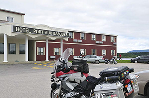
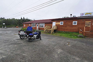
Rolling off the ferry we continued all of 1 mile before getting to our hotel for the night: Hotel Port Aux Bacques. We went to the local grocery store that had a selection of South African wines. Dinner a Subway Sandwich and Pinotage; a good combination.
Travelling with our iPads, we now appreciated the wifis of hotels. We did research for the next day's ride, made reservations for camping and lodging, and Skyped the family. Making reservations in Newfoundland was important since a wedding in town or a car rally or a baseball tournament can fill up all available lodging, as we've discovered.
Day 7 — Thursday August 4, 2011
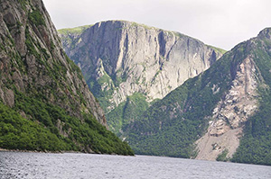
We left Port aux Basques heading towards Gros Morne National Park, a national park on the west coast of Newfoundland and a UNESCO World Heritage Site. We encountered some road construction along the way and some rain, but rolled into Rocky Harbor around midday with a few clouds and sun above. At the visiting center we made reservations for an afternoon excursion to Western Brook Pond, a land-locked fjord. We found a tent site at the Gros Morne RV/Campground where new sod welcomed us. After a non-descript lunch, we headed into Gros Morne to Western Brook Pond.
Rocky Harbor and our site for the night
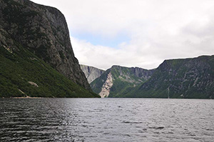
Gros Morne is the Northern end of the Appalachian Mountains and a rugged, beautiful park. Western Brook Pond, according to wikipedia.org, is:
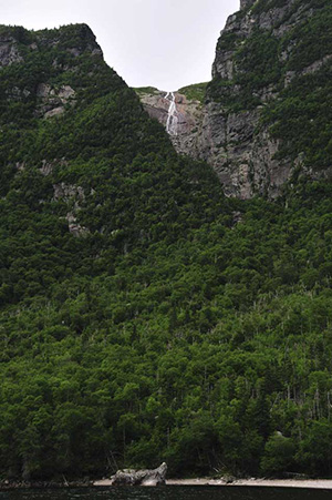
a fresh water fjord which was carved out by glaciers during the most recent ice age from 25,000 to about 10,000 years ago. Once the glaciers melted, the land, which had been pushed down by the weight of the ice sheet, rebounded and the outlet to the sea was cut off. The 30-kilometre (19 mi) long narrow "pond" then filled in with fresh water. The water in the fjord is extremely pure and is assigned the highest purity rating available for natural bodies of water. Pissing Mare Falls, the highest waterfall in eastern North America and 199th highest in the world, flow into Western Brook Pond.
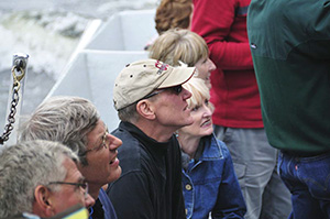
Amazing: earth that get's squashed up and then rebounds. We do live on a patient planet! Making your way to the fjord, one has to hike almost 2 miles over marshy, but flat terrain. Barry and I enjoyed the stretching of our legs and worked up a sweat in no time. The boat ride on the fjord brought a moose, wind, a few drops of rain, and sunlight. I also ran into a man from Pretoria (South Africa), visiting his brother who is an academic in Canada.
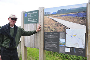
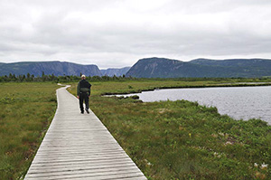
The boardwalk to Western Brook Pond
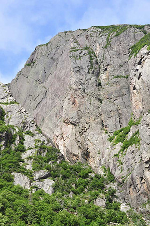
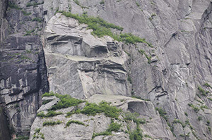
The new meaning of a rock face

Pissing Mare Falls
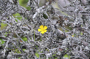
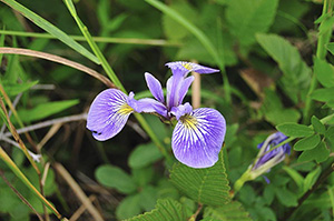
Flowers on the walk back to our motorcycles
After visiting the fjord, we had cod and chips at the local diner. It was a good meal.
Day 8 — Friday August 5, 2011
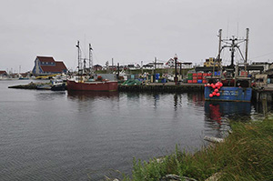
We had a good night's rest in Rocky Harbor and returned to TCH, the Trans-Canada Highway, as Highway 1 is named, moving east. We wanted to explore some of the fishing villages off the main route and headed to Twillingate on RT 340. It was cold (low 40s in F), wet, and windy. We stopped at the visitor's center only to discover that there was no lodging available in the area. A wedding had filled all the beds. We continued onto Twillingate, enjoyed tea, coffee and something sweet at a coffee shop. It is a quaint fishing village that felt exposed to the weather of the north Atlantic, despite boasting with a protective harbor. The Twillingate Islands' communities in Notre Dame Bay know fishing well, since farming there is not really an option. We did, however, pass one saw mill that looked busy. We inquired about icebergs, since Twillingate calls itself "The Iceberg Capital of the World," but we were told that there were none close at this time. I was grateful, for venturing out into the ocean with the wind howling did not feel like a good option.
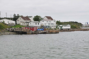
Homes in Twillingate. We warm up in a coffee shop. They had no ice for my HOT tea
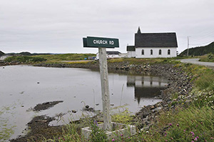
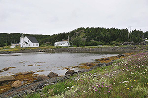
The church was for sale. Another steeple that cries.
Without beds available, and with the weather removing camping as an option, we headed to Gander, the next place where we could find lodging. It was cold, windy, and wet as we rolled with RT 330 into Gander, only to discover that there is a baseball tournament in town and that lodging is limited. Gander is a bit of a hub. Also for air travellers. St. John's was experiencing fog and rain and planes were diverted to Gander. Thanks to my Garmin Zumo we found a good-enough hotel and enjoyed the hospitality of the hotel's restaurant.
Day 9 — Saturday August 6, 2011
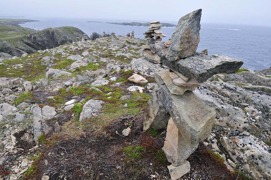
Last night we made reservations to stay over in Witless Bay (Elaine's B&B) on the east coast of Newfoundland. We woke to rain and made our way out of Gander. We continued east on TCH through Terra Nova National Park. We turned off on the RT 230 and headed to Bonavista, a quaint harbor town on the Bonavista Peninsula. It remained cold, windy, and at times wet, and my hearty breakfast late morning included chowder soup. It warmed me up well. The small working harbor looked peaceful, but I could imagine fierce looking waves beyond the breakwaters. Cod fishing placed Bonavista on the map, like many fishing villages in Newfoundland. At Cape Bonavista, a rugged outcrop, we saw whales in the distance, puffins flying about, and inukshuks people have erected. Seeing these rock sculptures, with longtime roots in Inuit culture, was one of the highlights of the trip.

Bonavista and its harbor

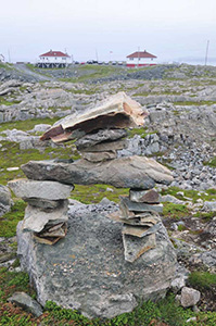
Inukshuks on Cape Bonavista
We also visited the small historic French town of Trinity. It began to rain just as we got there and explored less of the town as planned, but walking around in the rain was just not fun. In 1620 Trinity Bay harbor was seen as the best harbor in all of Newfoundland.

As we rejoined THC, we gassed up at a rest stop and I got rid of my rain gear as the clouds had lifted. A man walked over, asked about the direction we were heading (east), and said there is a major storm 30 minutes away. Just having gotten out of our rain gear, we headed east and indeed, 20 minutes later we had to stop to put on our rain gear again. But this time the rain came with very strong winds and periods of fog.
The winds were so strong that, as the beads of water accumalated on my visor, they would be wiped clean off, as if squeegeed off. Soon we were blown all over the road, with cars going much faster than we were. It was obvious that this had become dangerous and at the Fairhaven/Bellevue crossing on the TCH, we got off the road. We thought we'd try Fairhaven first for lodging, but the road should have warned us. We embarked on a narrow, pot-holed, almost one-lane road for seven miles. With no trees or other cover, the wind was howling. Reaching the town, the rain kept coming down. We had no choice but to knock on doors asking for a Samaritan to take us in. The first house Barry knocked on was locked up. I flagged down a car and a lady, probably startled by a Michelin looking spaceman with a flip-helmet on his head, told me in no uncertain terms that there are no B&Bs in this are and that nobody would take us in, even if we would pay them. She drove off leaving us wet and we decided to head back to the TCH crossing and try Bellevue.
We never made Bellevue, but at Bellevue Beach we came upon the Osprey's Nest Restaurant and Bar. I entered, asked, and we were directed to the Fiddler's Green Tourist Cabins, only to hear there is no vacancy. We were told that the cabins are occupied by long-term renters who work in a nickel factory that is being built nearby. The nickel is brought in from Labrador. Back to the bar we go. This time Barry tells our sad tale of being blown off the road, and the hostess have pity on us, calling the owner, Rod. Rod, like many, are building lodging for all the factory workers who need a bed. His rooms have been dry walled, had windows and electricity, but no running water. This place became our home for the night as we camped amidst drywall dust. Having the restaurant 20 paces away and the bar only 10, however, has its bonuses. I had cod tongue, which was great! We enjoyed the evening listening to stories about economic boom, the fishing industry almost dead, and appreciating local folks like Breen. Before we turned in--the bar kept on going--we gave Rod, who wanted nothing for his hospitality, $50 to frame as the first income he got for his new lodging venture. Being close to the bar, I can imagine he will have no shortage of renters.
Rod, his wife, and Barry. Breen wanted to be in the picture too
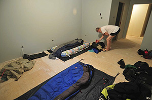
Our room for the night. Not quite a stable in Bethlehem, but we could resonate
We had a good night's rest, relieved to be off the road and out of the rain and wind. Elaine's B&B at Witless Bay will see us next time.
Day 10 — Sunday August 7, 2011
We woke around seven and headed to St. John's, the capital of Newfoundland. It rained most of the way and we entered the city in rain. The first hotel we visited was full and we landed a space at the Holiday Inn, glad again to be off the road. We spent the rest of the day resting and planning our ride back to Argentia, where we will get the ferry on Tuesday. With rain and wind outside we had no intension of exploring "North America's oldest city" beginning some time before 1620. The food at the restaurant, Eastside Mario's was just fine.
Day 11 — Monday August 8, 2011
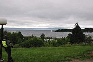
For the first time in days the rain let up, the wind was less, and we headed to some of the sites St. John's offered. The first stop was Signal Hill. The hill overlooks the rugged coastline on the one side and the harbor and city on the other. Cabot Tower, a big old stone tower, celebrated the 400th anniversary of John Cabot's landing. On 12 December, 1901, Guglielmo Marconi received the first transatlantic wireless communication on the hill.
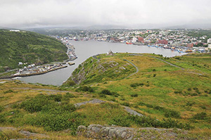
The view from Signal Hill. St. John's and its harbor
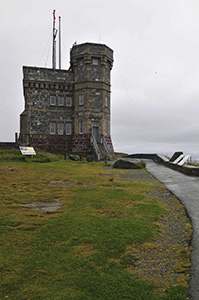
Cabot Tower and a sign that states the Titanin went down 584km / 365 miles off shore
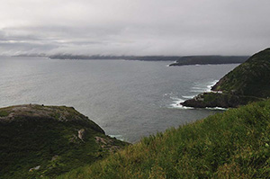
Riding to Cape Spear, we passed through downtown St. John's. I appreciated the many ethnic restaurants I saw, the harbor close by, and vowed to return. Cape Spear is on the Avalon Peninsula on the southeast point of Newfoundland. Half of Newfoundland's population lives here. Cape Spear has a rugged coastline and relics from World War II can be seen, the soldiers never seeing battle.
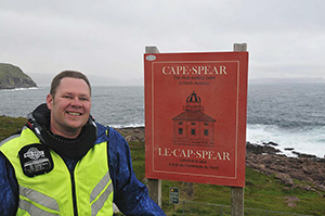
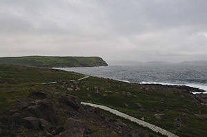
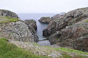
The rugged shore of Cape Spear
From Cape Spear we rode through Petty Harbor, very quaint but we did not stop, and had breakfast at Kevin's Restaurant in Doyles, south of St. Johns. Kevin was a kind host and informed us that he bought a place just yesterday in St. Pete's Beach, FL. He was very proud and excited about his purchase. Having experienced what was the worst summer in Newfoundland's recorded history, I can imagine why wants to escape to Florida in winter.
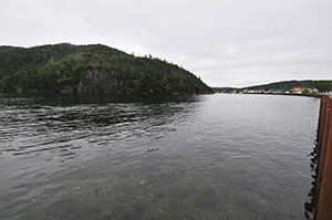
We continued on RT 10 South and then RT 13 West back to the TCH. From the TCH we turned off on RT 100 to Placentia/Argentia, the last night for us as we prepared to take the ferry back to Sydney, Nova Scotia.
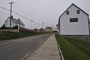
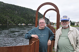
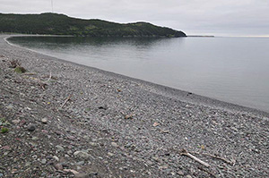
Placentia was an interesting place. As one who often plays with words, the town brought us many connotations. They were all wrong. Placentia was the ancient French capital of Newfoundland and was called "Plaisance"--"The Pleasant Place"--by the Basque fishermen. We stayed at the Bridgeway Hotel, a friendly place I highly recommend to all travellers. I walked the town with my camera and spoke with three gentleman as the tide was rushing in. They kindly told me that it was not a river flowing, as I thought. The gentleman shared some of the history of the town, how Americans took many women with them back to the US, and how they found it a great place for elderly folk such as themselves.
I loved the stone beach and spent more than an hour searching for stones I could give the three most important girls in my life, Michelle (of www.mothertongues.com fame), and our two daughters. Anticipating a 16 hour ferry, we bought some food and snacks. I bought one last bottle of Newfoundland South African wine--why Michigan cannot offer such a selection is beyond me--and we sought out the closets eatery, a pub 50 yards away. The Three Sisters Pub and Restaurant brought not only a good meal, but also a great conversation with a retired physicist who travelled here with his wife and RV.
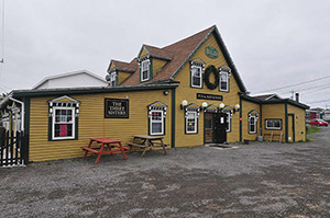
The Three Sisters Pug and Restaurant next to the tide that was rushing in
They have lived in Placentia all their lives. One of the few abandoned homes we saw
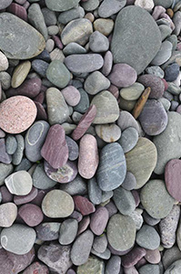
FIshing remains a way of life here. The stones were beautiful
We were ready for the ferry.
Day 12 — Tuesday August 9, 2011
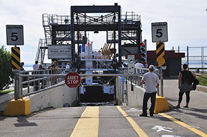
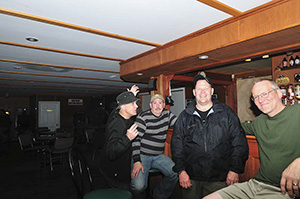
Ferries kill time. What I mean by that is that on the day you take the ferry you do nothing else and thus a day is lost. We spent the early morning relaxing at the hotel before making our way, under light rain, to Argentia. We rode to Argentia hoping for a coffee shop, but on this abandoned--and now reclaimed--US Navy Base we saw nothing but hangers. Under light rain we headed back to Placentia and stopped at Phillip's Cafe and Bakery. We joined the table of Mark and Jennie who, like us, have travelled Newfoundland on motorcycle and were awaiting the ferry. They are a great couple from Ohio. Mark is an avid Ski Patrol person and also a blogger, so visit his SITE. The kitchen pass he refers to is the one Jennie gives him to go motorcycling. One of the best things of motorcycling is the people you meet. Mark and Jennie prove that. Great people with wonderful stories to share. With lunch approaching we were told in no uncertain terms to either buy lunch or move on. We all decided to go to the terminal and await the ferry.
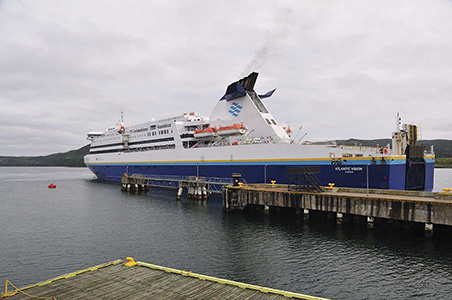
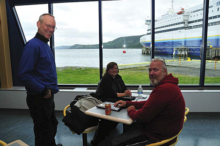
Barry with Mark and Jennie and the Atlantic Vision in the background
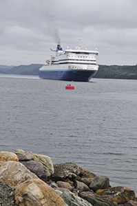
At the terminal we met Murray from Toronto on his big KTM 990. I had my last Newfoundland cod in the cafeteria and with rain coming and going, we boarded the Atlantic Vision. Even though it was a 15 hour trip, we decided against a sleeping booth, which was expensive. Barry heard some seating on the 8th deck was the best and I went ahead to secure some seats while Barry secured his bike. We found good seats and even though sleep came and went, we had a good trip to Sydney.
Day 13 — Wednesday August 10, 2011
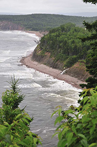
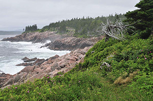
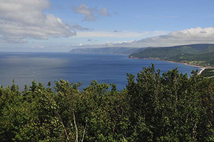
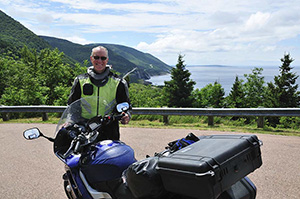
We arrived in North Sydney around 10:30am and headed towards Cape Breton, arguably one of the best motorcycle routes in North America. This Gaelic Island of Nova Scotia is a special place. At times you are right next to the ocean only to rise high above the surf. Then you cut through green forests and pass small fishing villages. The vistas was beautiful.
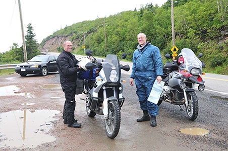
Murray and Barry looking at maps. The coast of Cape Breton
I wanted to visit Inverness to purchase some single malt Scotch at the Glenora Distillery. Sadly they came at a price-point I was not willing to pay and offered only large glass bottles. With more than 2000 miles left on our ride and little space on my motorcycle, I passed on the purchase. We had a meal in Inverness and moved on, saying goodbye to Murray after we crossed the Canso Causeway that links the island of Cape Breton and Nova Scotia.
Barry and I continued on RT 104 and after we ran into some rain, slept at the Wandlyn Inn near Amherst. This is a motorcycle friendly hotel that offered rags to dry out bikes. We ate in the hotel's dining room and researched the Bay of Fundy to get there at low tide.
Day 14 — Thursday August 11, 2011
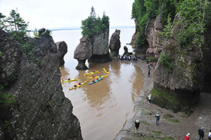
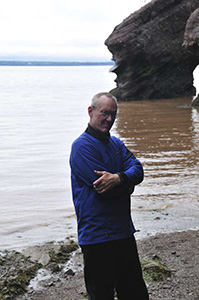
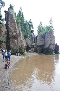
We left the Wandlyn Inn just as the rain and fog burnt off in the morning sun. We needed to go towards Moncton (New Brunswick) to get to the Bay of Fundy. Our waitress last night told us about the back road through Dieppe and it worked out fine as we avoided much of the morning rush hour traffic. We turned off on Route 114, rode through small villages (Weldon, Hillsborough, and Edgetts Landing) and headed towards The Hopewell Rocks on the Bay of Fundy.
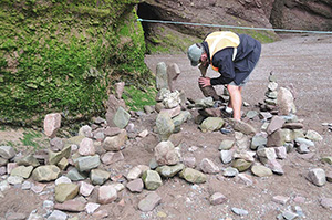
We got there just as low tide was ending and could walk on the shore. I spoke with an artist who makes rock sculptures every day and then waits for the 40 foot / 12 meter tides to come in and undo his creations. The hight of the tides still boggle my mind and as one can imagine, shapes the shore constantly. The rocks, pinnacles and arches are beautiful. I appreciate the explanation of the Mikmaq first people who said that the tides were formed by a whale splashing in the water. From wikipedia.org:
Oceanographers attribute it to tidal resonance resulting from a coincidence of timing: the time it takes a large wave to go from the mouth of the bay to the inner shore and back is practically the same as the time from one high tide to the next. During the 12.4 hour tidal period, 115 billion tonnes of water flow in and out of the bay.
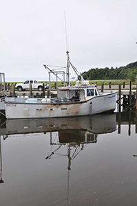
As the tied was coming in, we moved on to Alma, our last sightseeing destination before our turn home. During low tide the boats in Alma's small harbor lies on a muddy seabed (Follow the link for a few photos). We got there as the tide was coming in and did not see the full effect, but saw ladders and braces used to stabilize the boats as the water recedes. On a previous visit Barry passed through Alma as well, and he recalled the B&B where they stayed. We spoke with a few BMW riders from the Boston area who explored Nova Scotia, ate some pastries at the local bakery (I recommend lemon tarts), and turned home.
From Alma we rode through the Fundy National Park on RT114 and turned west on RT1. The road was mostly a two-lane highway and we made good time until we reached Saint John, the largest city in New Brunswick.
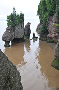
Can you see how the tide rushed in?
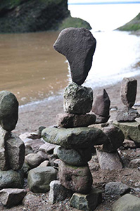
Art to be reclaimed by the tide
Alma harbor
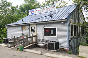
West of St. John the Canadians are moving mountains of earth as they widen RT 1. At our last gas fill-up in New Brunswick, a couple on a Harley asked about our route. When they heard our plans, they highly recommended that we visit the Eagles Nest Restaurant in Brewer, a short distance from Bangor, and try their lobster roll.
Crossing back into the USA at Milltown was without any difficulty and we were on RT 9, Maine, heading for the Eagle's Nest. Being on RT9 we rode past numerous abandoned farms, dilapidated homes, and more. It was markedly different from how I experienced Canada.
We arrived at Eagles Nest Restaurant just after 2:30pm, both of us ready for a lobster roll. The restaurant seats only about 30 people and we were lucky to arrive after lunch. People can wait many minutes to receive a table. The lobster roll was simple but large and I could see why it was recommended to us. I'll do the same from now on. And then came dessert. Both of us ordered carrot cake and out came a piece the size of 1/4 to 1/5 of the whole cake. It was sinfully delicious.
With an aversion for interstates, Barry and I planned on riding home on secondary roads, even if it slows us down a bit. By now our homing instincts kicked in and we planned no more siteseeing stops. Asking the table next to us about directions, the man suddenly mentioned the word "sabbatical" and I commented that he must be an academic, since only academics use this word. It turned out that he teaches at Bangor Theological Seminary and, when he heard Barry's last name (Bandstra), told us with a sense of surprise on his face that he uses Barry's books in his class. What a small world we live in.
We left the Eagles Nest Restaurant vowing to return and continued on RT 9 and then RT 2 as we crossed Maine east to west into New Hampshire. We finally made it to Gorham in the White Mountains and home to Mt. Washington. The town was bustling, but I pondered that the we saw the Apalachian Mountains that form the White Mountains in Newfoundland! After our late lunch of lobster roll and carrot cake, we decided to skip dinner.
Day 15— Friday August 12, 2011
We left Gorham early and stayed on RT 2 passing Jefferson and Lancaster until we hit RT 91 South. New Hampshire is beautiful and the White Mountains on our left preached a might sermon. We stayed on the interstate just a while and then took RT 4 towards Lake George. Breakfast near Queechee was wonderful and soon we were back on RT 4. We moved along at a steady pace passing Killington (Vermont) and entering the Green Mountains. Our progress slowed as we came closer to Lake George and the RT 4/RT 87 crossing, where we ran into major tourist traffic and baked in the hot sun. We were on RT 87 for just a while before we got onto RT 67 after a free icee in Ballston Spa. That way we avoided Schenectady. When we got to I90 we got on the toll-way to make miles. Syracuse and Rochester came and went.
We entered Buffalo around 5pm and had to hustle with all the Niagara Falls tourists for lodging. Our first two attempts proved fruitless and then we found a bed in the Sleep Inn, conveniently close to the I290 that took us back into Canada as we made our way home. This is the same hotel Barry stayed in on a prior trip. We had a good steak for dinner at the Buffalo Roadhouse Grill and anticipated arriving at home the next day.
Day 16— Saturday August 13, 2011
We had a hearty breakfast at the hotel and shortly after 7am we were on the road. Crossing into Canada was no problem and we made good miles on the Queen Elizabeth Way, and then onto RT 401 and finally RT 402 that took us back to Port Huron/Sarnia. We were back in Michigan and with rain threatening, made it home around 2pm.
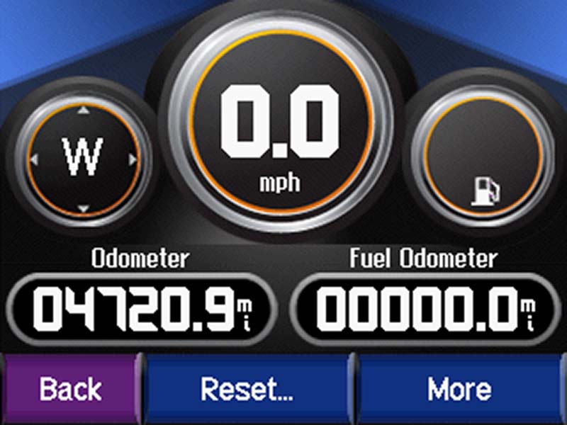
This was a memorable ride of 4720.9 miles, ferries not included. With enough time and a riding buddy such as Barry, I'll do it again tomorrow!
(All photos by JH)